Jussarö
Jussarö mining island is a unique combination of the history of fishing, maritime navigation, defense, and mining in the Gulf of Finland, and therefore it is protected as a nationally significant built cultural environment. The island's nature also reflects the wild nature of the archipelago and the impact of human activity.
You can visit Jussarö for a day trip or a longer stay. Jussarö can be reached by your own boat or by charter transport from the mainland. The island offers services provided by a partner entrepreneur of Metsähallitus. The guest marina with its services is open in the summer. There is also a café-restaurant operating on the island during the summer. The sauna can be booked in advance. You can stay overnight on the island in your own tent or book a room in one of the small accommodation trailers on the island. Reservations can be made throughJussarö (jussaro.net).
The island has a nature trail with two different options in terms of length and difficulty. The shorter trail is 3.3 km long, and the longer trail is 4.7 km.
There is drinking water available on the island.
Location
The nearest guest harbour, that can be reached by car: Baggö, Baggövägen 1275, Ekenäs
Coordinates Euref-Fin (~ WGS84) lat: 59° 49.8' lon: 23° 34.4'
By boat
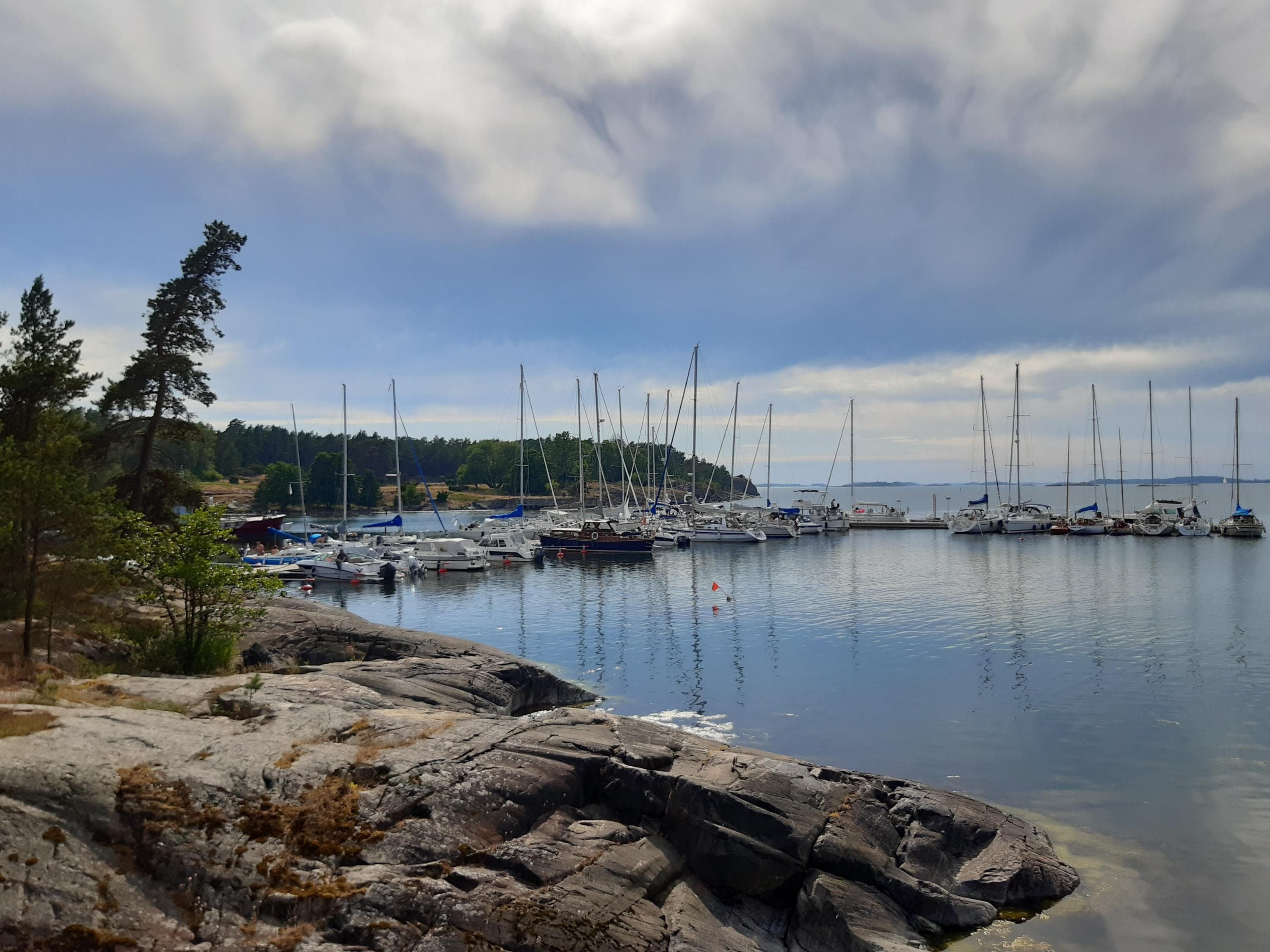
The Jussarö harbour is located on the northern shore of the island.
- Depth 2.5-5.5 meters.
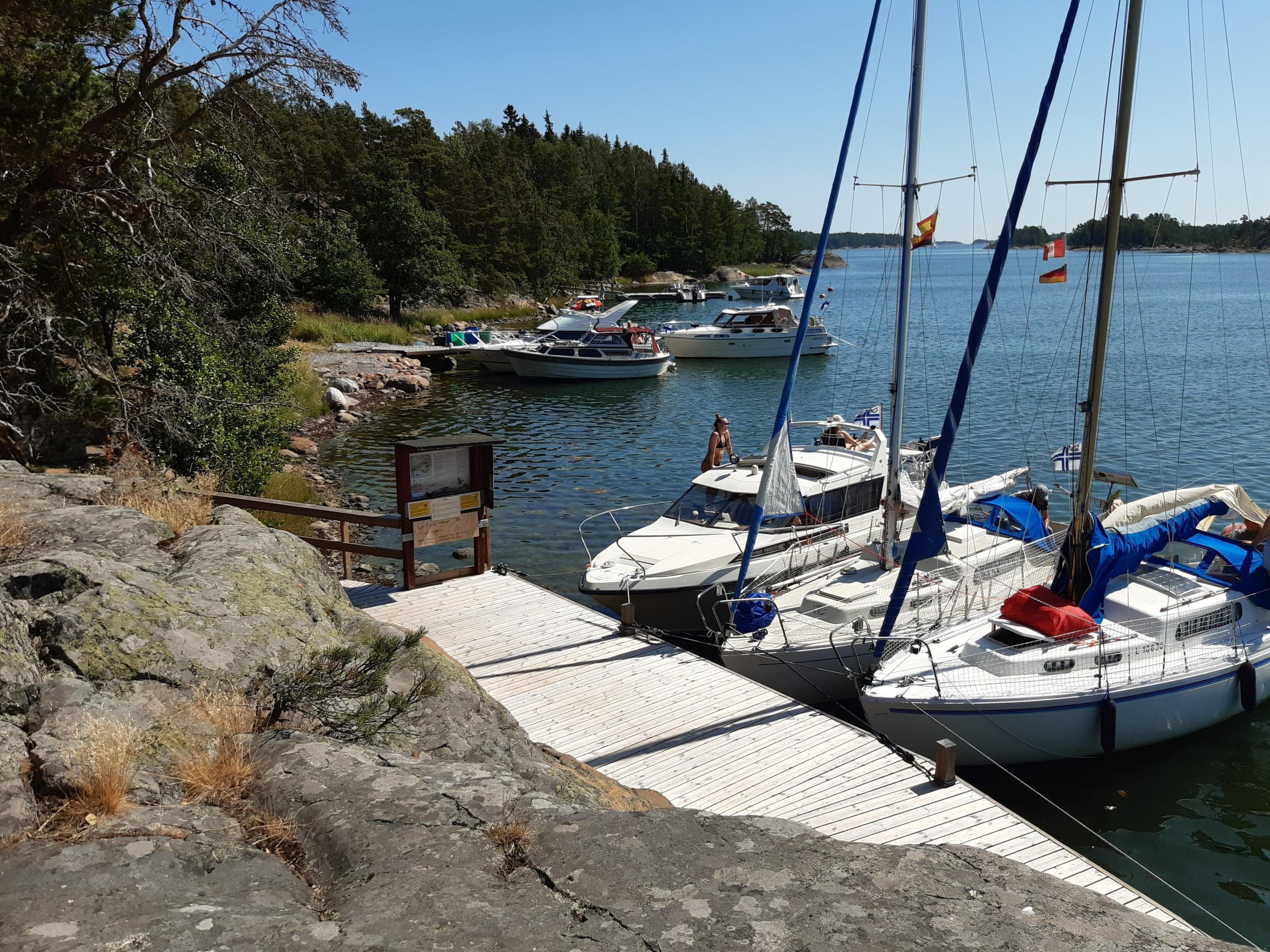
- The harbour pier has about 49 berths with mooring arms.
- You can also moor at the breakwater, which provides protection from westerly winds.
- The guest marina is chargeable (www.jussaro.net).
Other landings are allowed on the eastern side of the island, while on the western side, movement is only permitted on the nature trail.

Älgö
Älgö Island, located on the north-east boundary of the National Park, is the largest island of the Park. It is mostly covered in coniferous forests: in the gorge valleys there are handsome, stout and shadowy spruce forests (Picea abies) at some places, and light pine forests (Pinus sylvestris) in others. There are also wetlands and three small lakes, Storträsket, Näseträsket and Lillträsket. The shallow and sheltered bays on the eastern side of Älgö are typical for inner archipelago.
On Älgö Island, there is an old fishing farm, Rödjan, which is open during the summer. The fishing farm is the childhood home of Thorvald Strömberg (wikipedia.org), world champion in canoeing (1950) and olympic gold medalist in canoeing (1952). In the summer, sheep graze in the yard enclosure. The service structures in the farmyard and surrounding area are freely available year-round. The yard includes a dog run where dogs can run freely. A nature trail with an observation tower starts from the yard.
There is no drinking water on the island!
Location
The nearest guest harbour, that can be reached by car: Sommaröstrand, Sommaröstrand 44, Ekenäs
Coordinates Euref-Fin (~ WGS84) lat: 59° 51.9' lon: 23° 23.7'
By boat
Rödjan is located on the southern shore of Älgö island and has a excursion jetty.
- Depth: 1-2 meters.
- The harbour has two jetties. The jetty for larger boats has 6 buoys, while the jetty for smaller boats is equipped with mooring arms.
- On the rocks 200 meters west of Rödjan, there are several loops for mooring.
- Open to the southeast.

Modermagan
Modermagan has been a sheltered and popular natural harbour for generations. The island is named after the sheltered bay.
During the Second World War, there were also light field fortifications on Modermagan, as the island offers an excellent vantage point out over the open sea. Wartime ruins can also be found on many of the nearby islands. There is a nature trail on the Island.
Location
The nearest guest harbour, that can be reached by car: Sommaröstrand, Sommarönstrand 44, Ekenäs
Coordinates Euref-Fin (~ WGS84) lat: 59° 51.4' lon: 23° 25.7'
By boat
Modermagan is located on the north part of the National Park, north of the Skedö fairway.
- Depth varies.
- Rock mooring and anchor.
- Shallow-draft boats can land in the bay on the southern side of the island, where the threshold depth is about 1 meter.

Fladalandet
With its beautiful smooth rocks, Fladalandet has served as a popular natural harbour over the years. The bays and flads (a brackish-water lagoon) of Fladalandet are a paradise for boaters seeking a calm, sheltered harbour in which to stay overnight.
It is best suited for boats with a shallow draft. For sailing boats, there are also suitable sheltered areas that are good for mooring.
Location
The nearest guest harbour, that can be reached by car: Sommaröstrand, Sommaröstrand 44, Ekenäs
Coordinates Euref-Fin (~ WGS84) lat: 59° 51.2' lon: 23° 24.5'
By boat
Fladalandet is located south of the Skedö fairway.
- Depth varies.
- Rock mooring and anchor.
- Deep-draft boats are recommended to moor in the bay closest to the Skedö fairway, but there may be wake waves from the Skedö fairway. Be cautious if sailing, as there are shallow areas near the island.

Trelänningen
Trelänningen consists of four islands and several reefs. In the middle of the island group, there is a sheltered lagoon. Anchoring is prohibited in the bay in the southeast strait because it contains rare underwater vegetation in Finland, eelgrass. Eelgrass meadows provide shelter and food for many fish and small invertebrates. Eelgrass is classified as endangered both as a species and as a habitat.
There are no services on Trelänningen.
Location
The nearest guest harbour, that can be reached by car: Sommaröstrand, Sommaröstrand 44, Ekenäs
Coordinates Euref-Fin (~ WGS84) lat: 59° 50.4' lon: 23° 23.0'.
By boat
The lagoon is best accessed via the strait coming from the southeast, but anchoring is not allowed there.
- Depth is approximately 1.5 - 3.5 meters.
