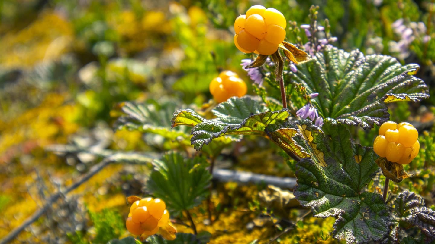
The peatlands of Sanginjoki: A new lease of life
The Sanginjoki Nature Reserve has a long history of commercial forestry. Originally, about half of the area consisted of peatlands, but these wetlands have been drained for forestry purposes for nearly a century. The aim of forest drainage was to transform peatlands into forest sites resembling mineral-soil heath forests. However, this significantly reduced the area's biodiversity. As a result of drainage, peatland habitats and small stream ecosystems have largely disappeared or been heavily altered. Today, the peatlands of Sanginjoki are being restored as part of the Helmi Habitats Programme, with the goal of bringing back more natural peatland, stream, and wetland environments.
Why and how are peatlands restored?
Restoring peatlands helps recover lost habitats, which benefits biodiversity, enhances the landscape, improves recreational opportunities, and supports valuable ecosystem services. Restoration also helps reduce carbon emissions and decreases nutrient loading in water bodies.
Typical peatland restoration measures include:
- Blocking, damming, or filling drainage ditches to prevent water from draining away too quickly and to raise the water table closer to its natural level.
- Constructing peat bunds across ditches so that water spreads more evenly across the peatland instead of flowing away through drainage channels.
- Removing trees to reduce evapotranspiration and help maintain wetter conditions.
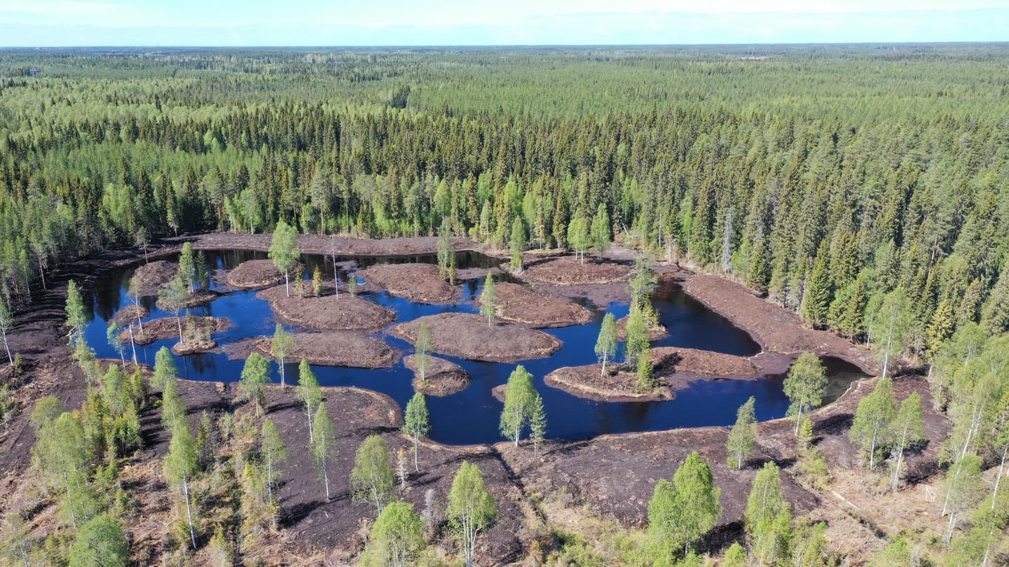
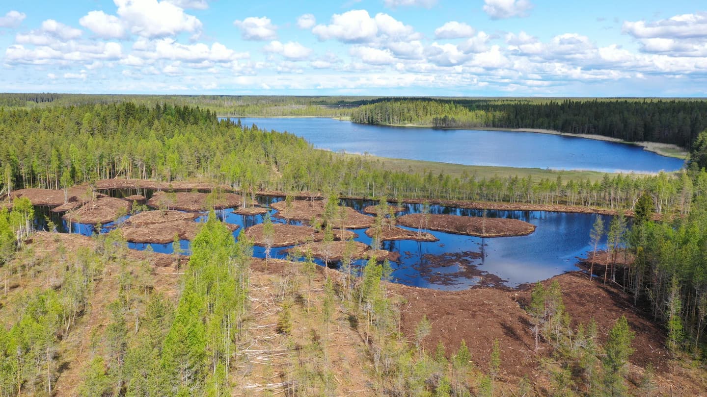
- Creating water protection wetlands to retain nutrients and other substances that may burden downstream waters.
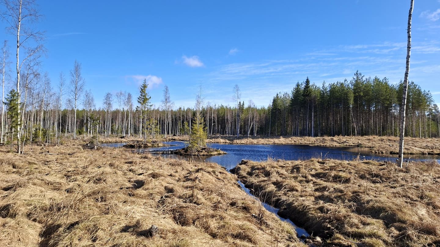
For a few years after restoration, the terrain is often difficult to traverse, and the landscape may appear disturbed or unattractive. Over time, as vegetation develops, the area gradually begins to resemble its original peatland state.
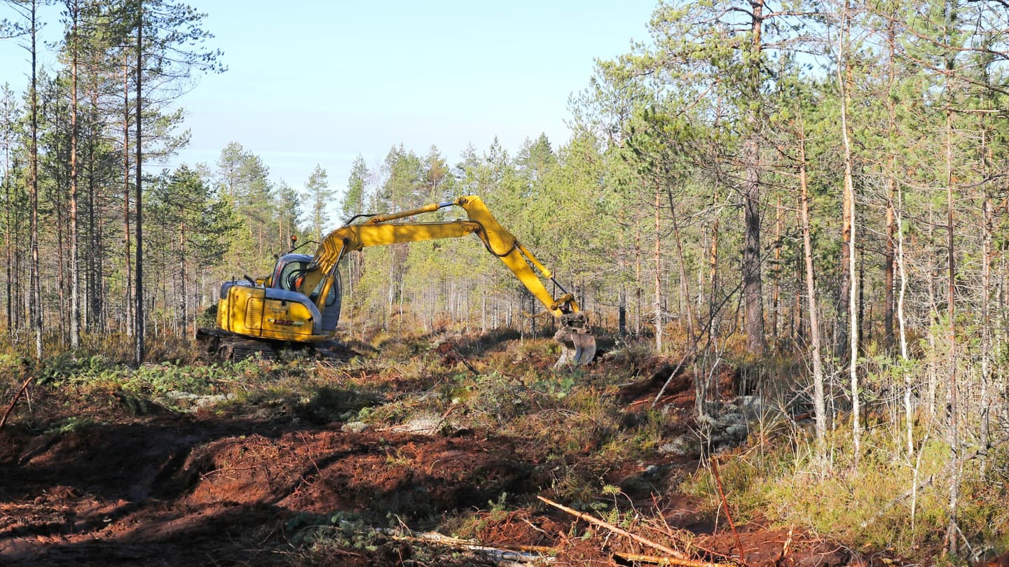
Changes are already visible in the Sanginjoki landscape
In recent years, the Sanginjoki restoration plan has been implemented as part of the Helmi Programme. Water protection wetlands have been created, ditches blocked, and trees removed to promote restoration.
The wetlands capture nutrients that may be temporarily released during restoration work. At the same time, they provide new habitats for birds and other wetland species. Deadwood has also been created to increase biodiversity, and stream environments have been restored to more natural conditions.
The restoration measures have already produced positive results, and the work will continue in the Sanginjoki Nature Reserve in the coming years.

Restoration sites
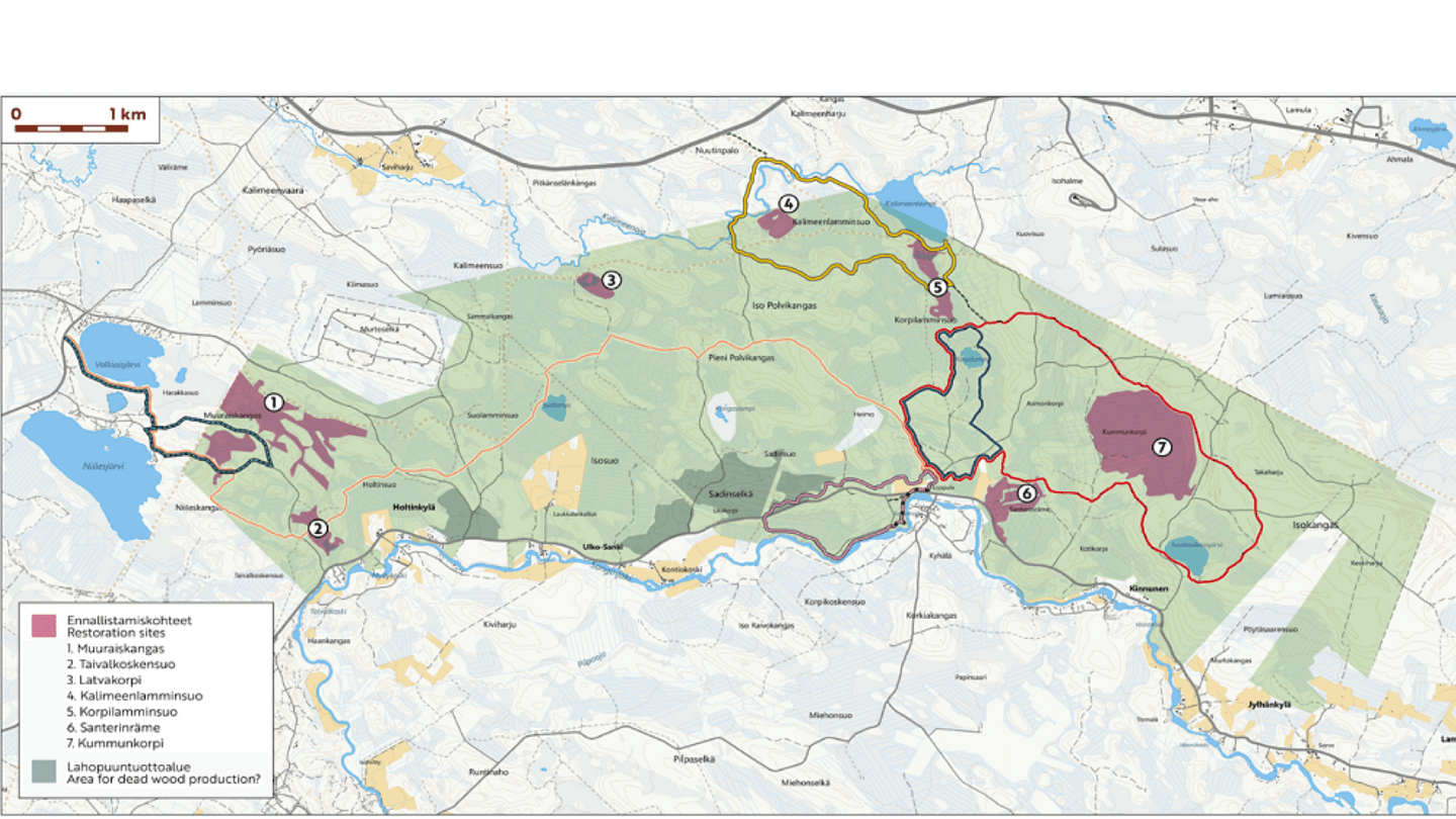
The map shows the locations of the restored sites.
1. MUURAISKANGAS
This peatland, drained since at least the 1950s, has undergone significant change. The most nutrient-poor areas now consist of pine-dominated dwarf-shrub peatland forests, while more fertile sections support mixed forests with bilberry-dominated peatland vegetation.
Because Muuraiskangas borders a species-rich peatland that remains close to its natural state, plants and animals are expected to spread rapidly into the newly restored peatland and wetland habitats.
The area also includes stony, relatively dry pine forests with trails that are used for outdoor recreation and berry picking.
2. TAIVALKOSKENSUO
The Taivalkoskensuo catchment area consists of a fragmented complex of small peatlands in the western corner of the area managed by Metsähallitus Parks & Wildlife Finland. Historically, small peat-filled depressions lay between rocky moraine ridges. Their waters collected in a small stream running along the Sanginjoki River and eventually flowed into the river itself.
On land managed by Parks & Wildlife Finland, the peatlands have been completely altered. The upper parts are covered by young pine stands, the lower sections by young mixed-forest peatland sites, and the lowest areas near the river contain small patches of old spruce forest.
Immediately beyond the boundary, however, peatlands on adjacent private land have remained undrained and in a natural state. These areas still support species typical of both wooded and open peatlands, making it possible for species to recolonise the restored sections.
3. LATVAKORPI
The most common original peatland types here were likely various fertile, wooded spruce mires. The area was drained at an early stage.
Despite extensive drainage, some species characteristic of both wooded mires and open bogs have survived, allowing them to spread into restored areas. At this site, the water protection wetland serves functions beyond nutrient retention. Due to an occurrence of black shale in the bedrock, acidifying sulphur may be released from the soil.
For most of the drained mire area, the goal is to restore spruce-dominated mire forest habitat.
4. KALIMEENLAMMINSUO
The peatlands here originally consisted of nutrient-poor, Sphagnum-rich pine bogs and open mires, mainly small peatland complexes. Drainage took place during the 1960s.
Logging was carried out in the 1990s, when spruce mires and small forested islands within the peatlands along Kalimeenoja Stream were clear-felled, ploughed, and planted with Scots pine and lodgepole pine. Today, the entire area consists of even-aged young pine forest.
Despite intensive drainage, some species associated with wooded and open peatlands have survived locally and can potentially spread into restored areas.
The banks of Kalimeenoja are a popular recreation area. Water from the ditches of Kalimeenlamminsuo flows towards the shore of Myllykoski Rapids through a dredged, iron-rich ditch that is being restored to a more natural stream-like condition near the rest area.
5. KORPILAMMENSUO
Korpilammensuo is broadly similar to Kalimeenlamminsuo. Originally, the area was dominated by nutrient-poor Sphagnum-rich pine bogs and open mires.
Today, the peatlands within the catchment area have been heavily altered and resemble drained peatland forests. The poorer sections are dominated by dense, pole-stage pine stands. In the more fertile northern areas, birch occurs as an understorey species.
Near Lake Kalimeenlampi, there are patches of unproductive land as well as almost natural open fens. Despite extensive drainage, open-mire species have survived in the area and can potentially spread into restored habitats.
6. SANTERINRÄME
This sub-area covers approximately 30 hectares at a bend in the Sanginjoki River. About two-thirds of the area was originally peatland.
Poor pine bogs occupied the depressions between small moraine ridges. The entire area has been drained, and the drainage network was further expanded in the 1990s, when forests on peat soils were also harvested.
Today, the central sections consist mainly of nutrient-poor peatland forests supporting dense, even-aged young pine stands. Naturally, the area formed the nutrient-poor outer edge of the Kummunkorpi-Asmonkorpi catchment area.
7. KUMMUNKORPI-ASMONOJA
The Asmonoja catchment area includes the western parts of the Isokangas sorted sand formation, the peatland groundwater discharge zone at its base, and a peat-filled depression located between the heath forests of Isokangas and Korpiselkä. More than half of the area was originally peatland.
A small part of the area lies north of the state forest boundary on private land.
Groundwater discharging from Isokangas is essential to the peatland ecosystems of this area. A significant portion of the groundwater emerged as small open springs at the edges of the esker-like formation. From these springs, water flowed through tiny spring-fed streams and eventually formed Asmonoja Stream in the bottom of the depression.
As recently as the 1950s, most of the area remained in its natural state according to topographic maps. Comprehensive drainage was carried out during the 1960s.
Today, most peatlands, springs, and streams in the area have been completely transformed. Nevertheless, species associated with wooded and open peatlands have survived in places despite intensive drainage, making recolonisation of restored habitats possible.
The strong groundwater discharge and the persistence of modest spring-fed species communities in the drainage ditches provide particularly favourable conditions for successful restoration.
The information in this article is based on extensive surveys and assessments of the Sanginjoki area carried out by specialists from Metsähallitus Parks & Wildlife Finland.